
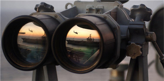
Pirate attacks off the coast of Somalia and the sea-borne infiltration of terrorists into Mumbai are graphic (and recent) reminders why maritime domain awareness — being aware of activity occurring on or under the water that has a direct impact on a country’s safety and security — matters. Transatlantic cooperation has already succeeding in making the Mediterranean a safer place. Now it is time to direct our attention further afield.
The primary threats in the maritime domain consist of piracy, smuggling, and organized crime which may be involved in either or both of the former activities. During the U.S. European Command Program Highlights presentation in March 2006, Admiral Henry G. Ulrich, then the commander of naval forces in Europe and the U.S. Sixth Fleet, noted that “maritime safety and security are vital for economic development and human security.”
And we’ve been warned. In December 2006 the Mumbai Intelligence Bureau concluded that terrorists, in this case, members of Lashkar-e Taiba, were being trained “to handle large boats, laying of mines in coastal zones and planting of explosives under dams, bridges, ships etc.” as well as “being taught navigational techniques, rescue operations, surveillance methods, concealment of explosives and underwater attack on enemy’s coastal targets/vessels.” Of specific concern to Indian intelligence was that such operatives “were planning to infiltrate into the coastlines and island territories disguised as fishermen.” And as we’ve seen in East Africa, the line between legitimate fisherman and maritime brigand can sometimes be non-existent.
And yet, in a number of critical maritime regions of the world, the problem has only grown over time. Take the Gulf of Guinea in West Africa-a region of the world that supplies some 15 percent of America’s oil. Reported piracy in Nigeria alone has increased by 350% from 2006 to 2007 (12 reported cases and 42 reported cases respectively). All of these incidents occurred within 12 nautical miles of Nigeria’s coast, and the majority occur in or near major ports. In Lagos, Nigeria’s largest port, there have been 40 reported acts of piracy and nine attempts from January 2005 to September 2008, with 12 of these cases occurring within the port itself.
One of the most lucrative acts of smuggling as operated by organized crime is oil bunkering. The International Crisis Group, in the “Fueling the Niger Delta Crisis” report, estimates the between 70,000 and 300,000 barrels of oil per day are bunkered illegally in Nigeria alone. These estimates are per day! Using an average of 185,000 barrels per day at $60 per barrel comes to $11.1 million dollars in lost revenue per day. That comes to annual losses of [$4.05] billion. Much of that money may be for private enrichment, but it also provides a possible steady stream of income to organized crime and terrorist organizations as well.
Yet throwing money and personnel at the problem — or simply sending more ships out — is not a solution. While an effective enforcement capability is critical to implementing any form of security policy, without knowing where, when, and how to employ security forces, they will be at best ineffective, and at worst wasted, assets. Without the ability to monitor maritime traffic to a reasonable degree of confidence, any security force will either be overwhelmed with having to make physical searches of all unknown traffic, or those who would seek to benefit from the masses of legitimate traffic will be able to escape detection. Moreover, without an effective method to share this information with indigenous enforcement assets or those of neighboring countries, then the knowledge will have bee n wasted and only minimal security can be provided. Also, if individual ships are unable to communicate with regional enforcement assets, they will not receive help when needed.
Information is the key—and this is an area where the United States and its European allies have the technology at hand to make a difference. The first step in providing security in any area is to be aware of what is going on there. By maintaining a continuous watch on all maritime activity, patterns of normal operations could be identified and contacts which appear random or suspicious can be investigated by security forces.
The second step is the ability to effectively communicate among shore-based stations and to mobile security forces. The equipment for this is readily available and simple to use.
The Automated Information System (AIS) is a highly effective method to track the activities of maritime vessels out to a distance of approximately 20 nautical miles , which is more than enough distance to cover a country’s territorial waters from shore-based stations. AIS has essentially a line-of-sight capability, so the area to be monitored can be increased simply by increasing the height of the antennae. AIS operates in much the same fashion as an aircraft’s transponder by sending out information on its location, course, and speed. In addition, it also provides the ship’s name, type, point of origin, destination, and other navigational information specific to that vessel. Through its software architecture, up to 4,500 contacts can be reported and tracked at any one time. While international requirements only mandate its use on vessels larger than 300 tons displacement, it can provide a ready source of information for port operators and security forces.
By electronically identifying vessels and their activities, security forces can then focus their attention on those contacts without an active AIS system. A new system called the Maritime Safety and Security Information System (MSSIS) uses AIS information and combines it with standard maritime surface radar and other commercial shipping data to create a comprehensive electronic display of vessels in the monitored area. An AIS network coupled with MSSIS is currently undergoing installation in the Gulf of Guinea. As of fiscal year 2006, $2.6 million dollars had been allocated for the installation and start-up in Ghana and Sao Tome and Principe. Nigeria is undergoing site surveys for installing AIS/MSSIS stations.
Creating these systems and working with regional partners is something that the United States and its European allies can undertake without having to invest huge amounts of money. Moreover, by offering the technology and expertise, the West can cooperate with those states prepared to offer the personnel — a process already underway in West Africa. India is now reviewing its own maritime security arrangements. Again, a lack of information can be fatal. A report in the December 1, 2008 Business Standard claims that half of the fishing vessels operating near India’s major ports on its western coast are unregistered. Perhaps the United States would be prepared to direct some of the promised aid to helping New Delhi implement its 2006 Coastal Security Scheme. This would open up another venue for cooperation. Over time, there is no reason why the Indian Ocean basin and the waters of the South Atlantic surrounding both coasts of Africa could not have similar coverage as the Mediterranean today currently enjoys. With the introduction of AIS and MSSIS in Africa and the Indian Ocean basin, the ability to share this information among shore installations will prove its effectiveness if a continuous area of coverage can be achieved.
Pirates, terrorists and criminals take advantage of our blindness to operate. Improving our maritime vision is a necessary first step in fighting back.
Lieutenant Commander David Sagunsky (USN) is a graduate student at the U.S. Naval War College. Nikolas K. Gvosdev is a professor of national security studies at the same institution. The views contained in this essay are entirely their own. Photo by Flicr user wave-rider under Creative Commons license.
Image: navy-binoculars.programthumb.jpg