
Predicting a hurricane’s potential impact is a complex endeavor, based on a range of factors including geography, storm surge, rainfall, gale diameter, storm speed, wind speed, and many others. The Saffir-Simpson Hurricane Wind Scale—adopted in the wake of Hurricane Camille in 1973 to help communicate hurricane risks to the public in a more understandable way and later simplified—is derived solely from wind speed, however.
While Saffir-Simpson provides a useful shorthand, it cannot capture the full magnitude of damage that a potential hurricane may inflict. In fact, twelve of the thirty-six most damaging storms to make landfall in the United States since 1950 have been Category 1 or 2 storms, and many of these hurricanes were accompanied by significant storm surges and floods.
Hurricane Florence, currently a Category 2 as it makes its final approach to the Carolina coastline, still has the potential to inflict severe damage.
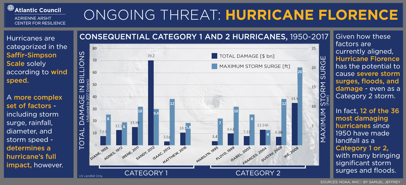
Image: A US HC-C130J approaches the edge of Hurricane Florence after a two-and-a-half-hour flight from Savanah Air National Guard Base in Savanah, Georgia, in this September 12 handout photo. (Technical Sgt. Chris Hibben/US Air Force/Handout via Reuters)