Mapped: Russia’s shelling of civilians in Kharkiv
Geolocating areas of Kharkiv damaged by Russian shelling. (Source: DFRLab/Google Maps)
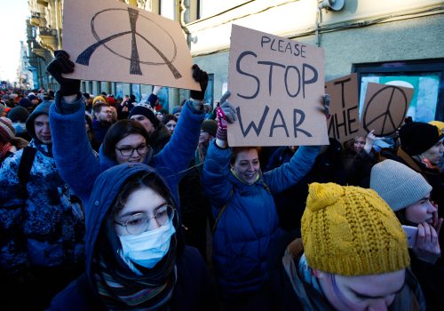
On February 28, 2022, Russia indiscriminately shelled Ukraine’s second largest city, Kharkiv, in an attack that claimed at least eleven civilian lives, wounding many more, and destroying homes. This incident was not isolated; as previously reported by the Digital Forensic Research Lab, Russia has shelled the city since the beginning of the war.
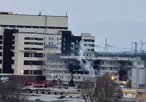
Compared to attacks during previous days, though, the February 28 attack was significantly more violent and brazen in its targeting of highly populated civilian population areas. The DFRLab analyzed and geolocated available imagery of the attack, identifying three main neighborhoods affected by shelling. While other areas were also affected, the Saltivka, 6th Mikrorayon, and Horizont neighborhoods appeared the worst hit.
The DFRLab is mapping out areas of Kharkiv hit by artillery on Google Maps.
Geolocations
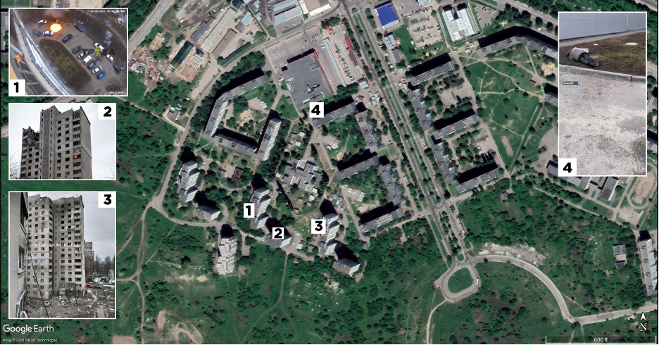
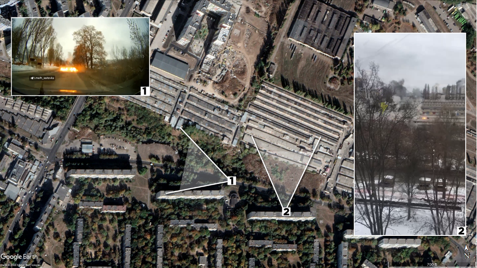
At 10:42 a.m. local time on February 28 in the eastern Kharkiv suburb of Horizont, a security camera at 128 Velika Kiltseva Street captured the moment when several explosions went off in rapid succession in the building’s adjacent parking lot and nearby pedestrian path.
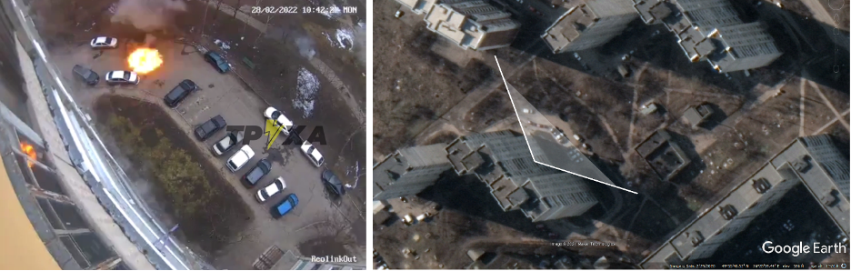
At least four pedestrians were visible on the footpath behind the parking lot, all appearing to have sustained injury from the nearby explosions. In another video shot in Horizont, a dead body can be seen lying on the ground behind a Velmart supermarket, two hundred meters away from the security camera footage.
Horizont suffered at least two rounds of shelling, eventually causing serious damage to buildings in the southwestern part of the neighborhood.
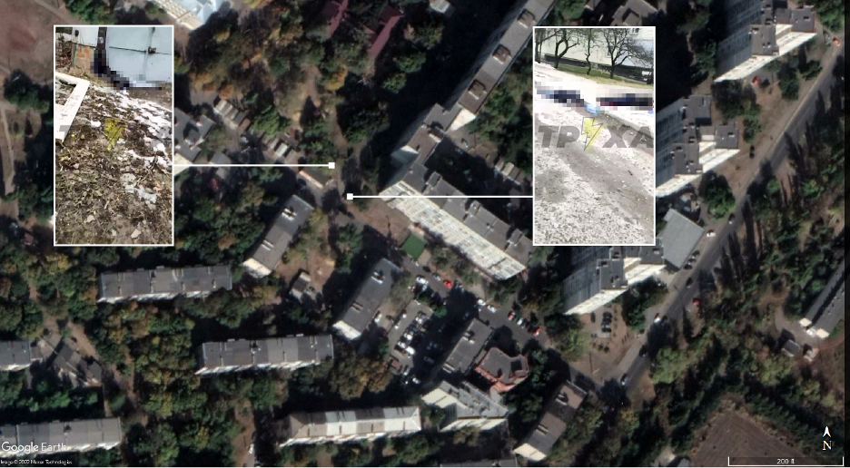
Along August 23rd Street near school number 135, in the district known as the 6th Mikrorayon, one of the grimmest scenes of the war up until then unfolded. In one spot, four people laid dead at a drinking water dispenser. By referencing Google Street View imagery, the DFRLab was able to pinpoint the location of the footage to where Ozerniy Pereulok meets August 23rd Street.
As with the attack on Horizont, the shelling of the 6th Mikrorayon affected a large area, destroying cars and damaging homes in addition to the human toll.
In the northern residential neighborhood of Saltivka, shelling hit a large garage area bordering on Buchmy Street. Given the large area that rocket artillery covers, nearby homes were also damaged. Dashcam footage and residents of the area captured the attack as it unfolded.
In other parts of Kharkiv, boosters the size of telephone poles from BM-30 300mm multiple launch rocket systems (MLRS) rained over the city, along with parts used to hold submunitions, also known as cluster bombs. Submunitions from BM-30 Smerch rockets were likely to blame for the carnage.
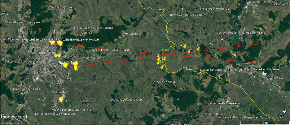
Following the debris patterns from Kharkiv city back into the Russian-Ukrainian border area, several potential burn marks were visible in Planet Labs imagery from February 27. In the above graphic, each number by the yellow pins on the right corresponds to the amount of burn marks identified at each site. Other tracks in the snow indicated likely howitzer firing positions, but these were far outnumbered by rocket launch sites.
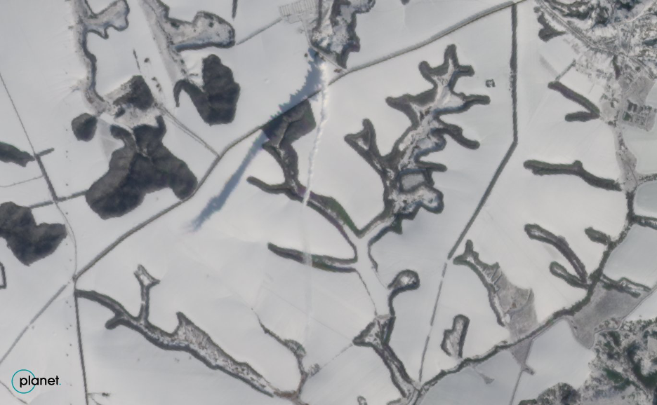
While these may not all be rocket artillery launch sites, some of them verifiably are, since Planet Labs imagery showed an MLRS launch site where the smoke plume from recently fired rockets was still visible. The effects of the wind on the smoke cloud made it difficult to track the exact destination of the rockets, but it appeared to point in the general direction of Kharkiv.
This article originally appeared on Medium.
Michael Sheldon is a research associate at the Digital Forensic Research Lab.
Further reading
Tue, Mar 1, 2022
Four ways the war in Ukraine might end
New Atlanticist By Barry Pavel, Peter Engelke, Jeffrey Cimmino
The United States, its transatlantic allies and partners, and the entire world face a difficult period of sustained contestation with Russia.
Mon, Feb 28, 2022
Russian Hybrid War Report: Russia retaliates against anti-war celebrities as social platforms crack down on Russian media
New Atlanticist By
Meta, Patreon, and Twitter are taking action against Russian accounts, while Russian celebrities are facing pushback for their views, according to the Council's open-source researchers.
Mon, Feb 28, 2022
Russian forces capture key Ukraine nuclear plant
New Atlanticist By
Follow along for the latest insights, analysis, and reporting from the Atlantic Council's experts as Russia steps up its military assault on Ukraine.
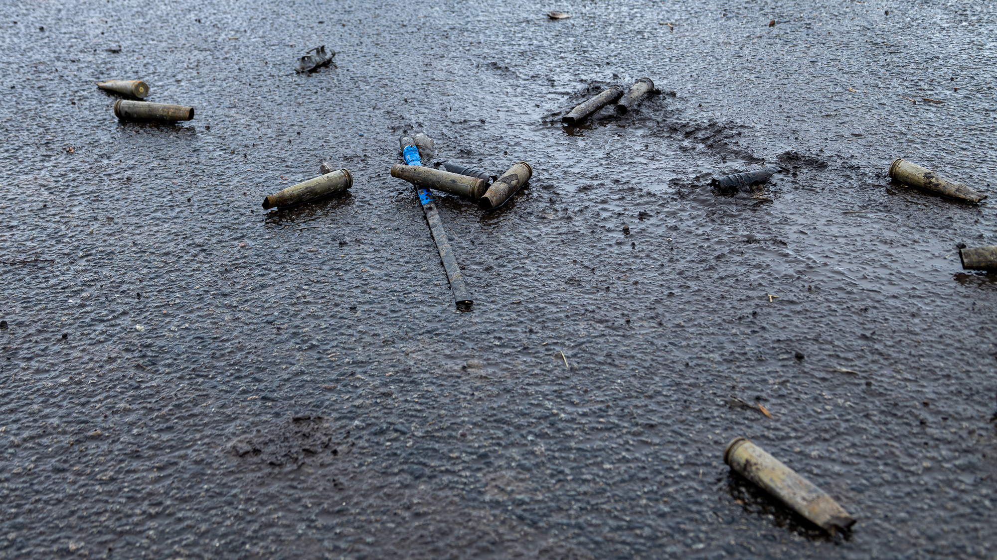
Image: Thirty mm shell casing on the ground on the northern outskirts of Kharkiv, Ukraine on Feb 26, 2022. Photo by Collin Mayfield, SIPA USA.